

Explore our projects
CMS GeoScience delivers a high-resolution geophysical survey for ABP Southampton


CMS GeoScience delivers a high-resolution geophysical survey for ABP Southampton
CMS GeoScience are proud to announce the successful completion of a major geophysical survey in Southampton, supporting future port development and navigational maintenance activities for Associated British Ports (ABP).
Operating within one of the UK’s busiest and most strategically important shipping corridors, our team mapped the seabed and subsurface conditions across a vast survey area extending from the Main Channel and The Solent to the Nab Channel.
Working in close coordination with Southampton Vessel Traffic Services (VTS) and ABP, we safely acquired, processed, and interpreted a comprehensive suite of high-resolution datasets within a live commercial port environment.
Our geophysical survey programme saw us successfully utilise our extensive in-house capabilities, combining high-resolution Multibeam Echo Sounder (MBES) bathymetric surveys, Side-Scan Sonar (SSS) seabed imaging, Sub-Bottom Profiler (SBP) shallow seismic investigations and subsequent geological and geomorphological interpretation.
Through rigorous survey planning and continuous quality control, we delivered high-resolution datasets that provided high quality geomorphological assessments across key navigation channels and operational areas. The quality of the multibeam and side-scan sonar data enabled detailed mapping of active sediment transport pathways, sand ripples, sand wave development, and overall dredged channel morphology alongside historical dredge footprints. Furthermore, the team successfully identified scour features associated with marine infrastructure, tracked distinct areas of sediment accumulation and erosion, and pinpointed seabed obstructions and anthropogenic debris.
Using sub-bottom profiler data, we successfully imaged the subsurface to assess potential geohazards and structural constraints, including buried palaeochannels, shallow gas indicators, and complex sedimentary transitions.
This work shows how committed CMS GeoScience is to strengthening our capabilities for the Ports and Harbours sector.
Because the Port of Southampton accommodates some of the largest container vessels, cruise ships, tankers, and Ro-Ro vessels in the world, these geophysical findings provide the critical baseline data required to ensure long-term maritime safety. The final data package delivers essential insights that directly support modern navigation channel management, capital and maintenance dredging design, vessel manoeuvrability assessments, and highly accurate under-keel clearance calculations.
This project highlights CMS GeoScience’s ability to provide fully integrated geophysical, hydrographic, and data interpretation solutions for major ports and marine infrastructure operators.
A huge thank you to the port authorities, VTS, and our multidisciplinary team for delivering this project safely, accurately, and efficiently, resulting in highly positive feedback and subsequent project extensions.
CMS GeoScience are proud to announce the successful completion of a major geophysical survey in Southampton, supporting future port development and navigational maintenance activities for Associated British Ports (ABP).
Operating within one of the UK’s busiest and most strategically important shipping corridors, our team mapped the seabed and subsurface conditions across a vast survey area extending from the Main Channel and The Solent to the Nab Channel. Working in close coordination with Southampton Vessel Traffic Services (VTS) and ABP, we safely acquired, processed, and interpreted a comprehensive suite of high-resolution datasets within a live commercial port environment.
Our geophysical survey programme saw us successfully utilise our extensive in-house capabilities, combining high-resolution Multibeam Echo Sounder (MBES) bathymetric surveys, Side-Scan Sonar (SSS) seabed imaging, Sub-Bottom Profiler (SBP) shallow seismic investigations and subsequent geological and geomorphological interpretation.
Through rigorous survey planning and continuous quality control, we delivered high-resolution datasets that provided high quality geomorphological assessments across key navigation channels and operational areas. The quality of the multibeam and side-scan sonar data enabled detailed mapping of active sediment transport pathways, sand ripples, sand wave development, and overall dredged channel morphology alongside historical dredge footprints. Furthermore, the team successfully identified scour features associated with marine infrastructure, tracked distinct areas of sediment accumulation and erosion, and pinpointed seabed obstruction and anthropogenic debris.
Using sub-bottom profiler data, we successfully imaged the subsurface to assess potential geohazards and structural constraints, including buried palaeochannels, shallow gas indicators, and complex sedimentary transitions.
This work shows how committed CMS GeoScience is to strengthening our capabilities for the Ports and Harbours sector.
Because the Port of Southampton accommodates some of the largest container vessels, cruise ships, tankers, and Ro-Ro vessels in the world, these geophysical findings provide the critical baseline data required to ensure long-term maritime safety. The final data package delivers essential insights that directly support modern navigation channel management, capital and maintenance dredging design, vessel manoeuvrability assessments, and highly accurate under-keel clearance calculations.
This project highlights CMS GeoScience’s ability to provide fully integrated geophysical, hydrographic, and data interpretation solutions for major ports and marine infrastructure operators.
A huge thank you to the port authorities, VTS, and our multidisciplinary team for delivering this project safely, accurately, and efficiently, resulting in highly positive feedback and subsequent project extensions.
Successful ground investigation project for ABP Southampton
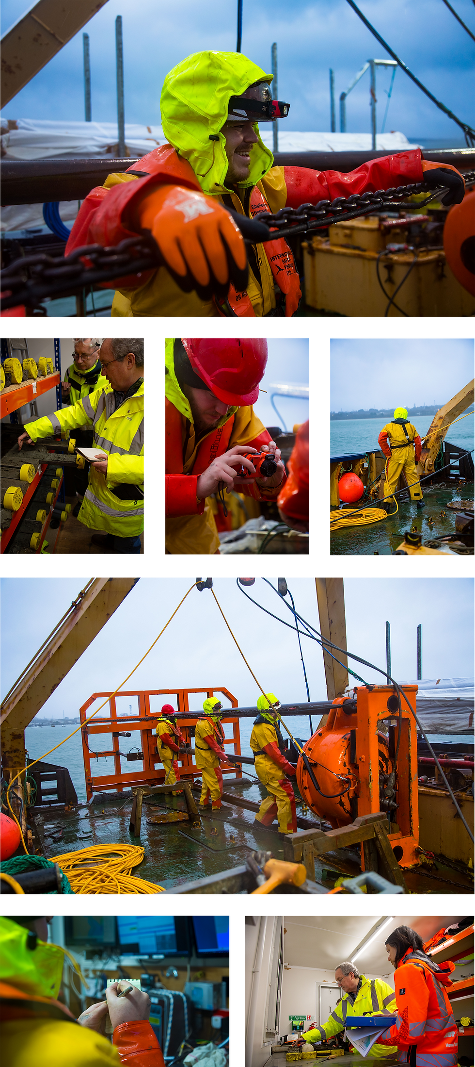
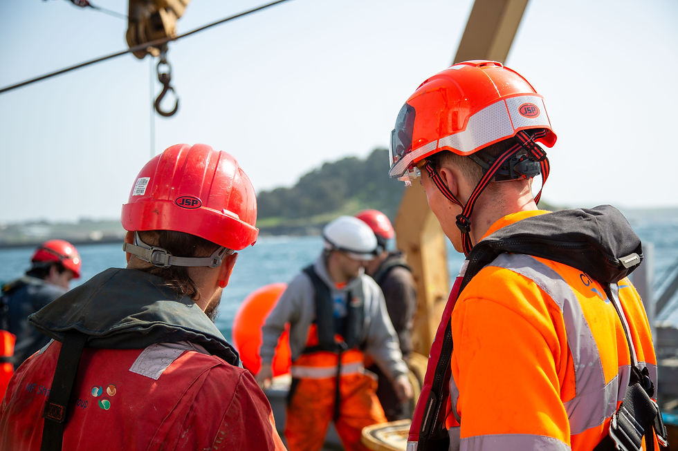
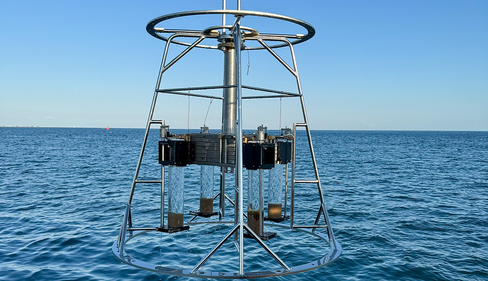
In January 2026, CMS GeoScience successfully completed a complex ground investigation project for ABP Southampton. The project was a collaborative effort between ABP Engineering & Asset Management (Southampton), The Bates Partnership, ABPmer, Wessex Archaeology and Southampton Vessel Traffic Services (VTS). We recovered 84 vibrocores, 49 surface grab samples, and 15 benthic analysis samples. Eight specific locations were dedicated to archaeological review, requiring the use of opaque liners to preserve sample integrity by reducing light impact.
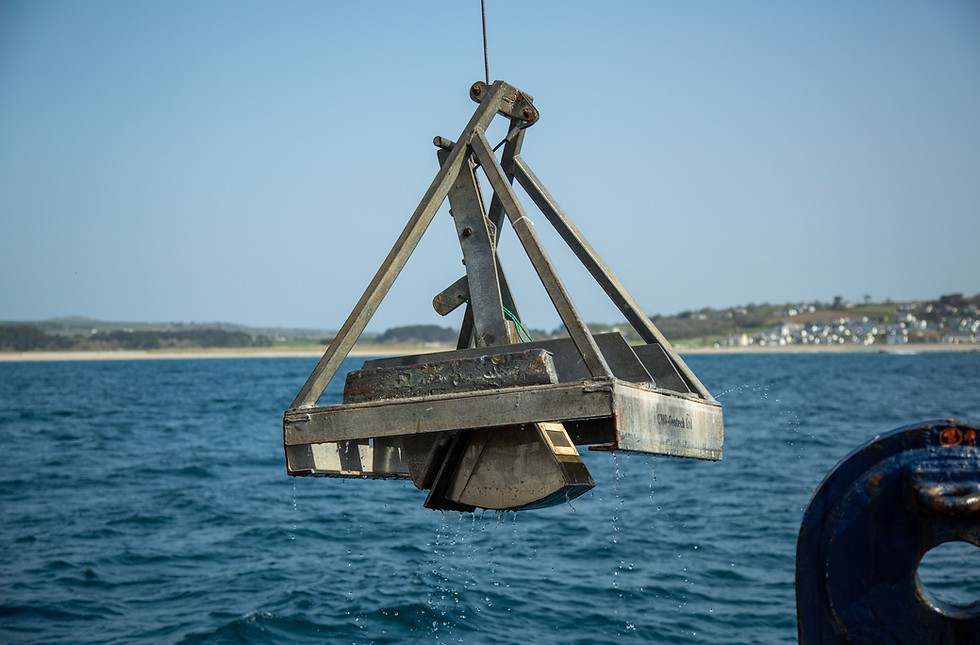
A critical requirement for the client was the validation of multibeam data and the measurement of bed levels at each location to a target accuracy of +/- 10cm. To meet this, the team utilised the vessel’s echo sounder to run crosslines at each station, processing data onboard to establish target depths. Furthermore, sensors on our in-house designed High Performance Vibrocore (HPVC) measured the rate of penetration and tilt on the seabed, ensuring the vertical accuracy essential for the client’s project requirements.
The onshore operations were supported by a comprehensive compound featuring offices, welfare facilities, and specialised labs for splitting, logging and photographing cores. Working alongside the Bates Partnership, over 90 samples were processed for laboratory testing, while strict contamination procedures were followed to collect more than 100 sets of sub-samples. To maintain compliance with project-specific Marine Management Organisation (MMO) requirements, temperature-controlled storage facilities were established on-site. This setup provided the client with the unique opportunity to inspect samples in situ, facilitating early insights and rapid data dissemination to the wider project team.
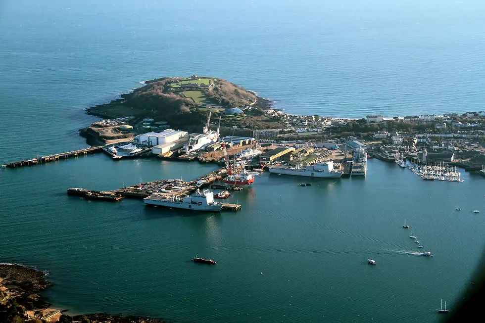
Southampton handles more cruise ships than any other UK port and is the second-largest container terminal, so maintaining uninterrupted operations was vital. CMS GeoScience collaborated closely with Southampton VTS to schedule work around heavy marine traffic, including ferry movements and commercial shipping in high-risk manoeuvring areas.
Environmental conditions posed a significant threat to the timeline with the arrival of one of the worst storms in forty years, Storm Goretti, at the start of the project. However, the impact was minimised through a seven-day rolling plan and the MV FlatHolm’s ability to remain on-site overnight. By utilising small weather windows and leveraging live tide data, the crew ensured that even exposed and drying areas were sampled safely and accurately. The vessel’s integration of Starlink connectivity allowed for real-time data sharing, enabling the client to view preliminary results as they were acquired and make informed operational decisions despite the volatile weather.
The successful completion of the campaign, with only half a day added across the entire project despite severe weather and intense marine traffic, reflects the strength of collaboration between all parties.
"CMS GeoScience recently completed the Southampton Port Marine Ground Investigation project on time and to budget," our project manager said. "We engaged with ABP in a collaborative approach to fast track the project over the winter months in order to meet challenging deadlines to deliver sample results. Despite a number of named storms passing through, the fieldwork was completed on schedule in January 2026. Making use of CMS GeoScience's own vessel, the MV FlatHolm, enabled the optimisation of productivity during short weather windows. This was vital to collecting data in exposed areas of the project. Careful planning, coordination and cooperation was required between the project team and Southampton VTS to ensure deconfliction between the busy shipping environment and sampling activity in the channel. Excellent communication ensured minimal project delays were incurred due to shipping movements. As a result of our efforts, the client has been provided with all MMO data within six weeks of starting onsite; this is a great result for the team."
Combining robust operational planning, advanced in-house equipment, real-time monitoring and comprehensive onshore support facilities, we provided high-quality, compliant data with minimal disruption to port operations. By successfully planning and delivering a complex marine ground investigation in a highly challenging port environment and despite severe weather and tidal limitations, CMS GeoScience demonstrates our ability to deliver reliable, high-quality and compliant results safely and efficiently under the most demanding conditions.
.png)
How CMS GeoScience overcomes the challenges of working in busy ports
.png)
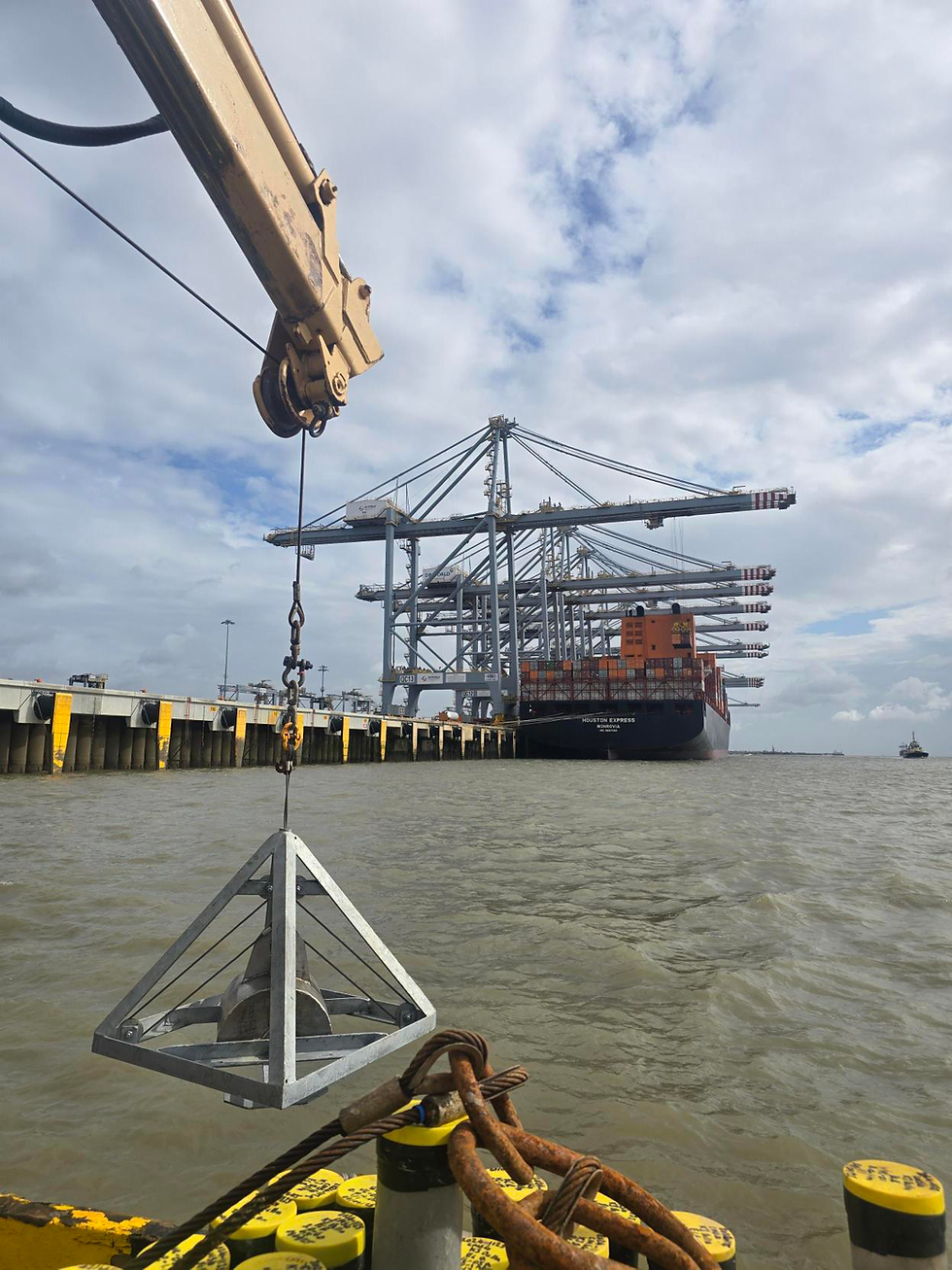
We undertook a geotechnical survey for the Port of London Authority (PLA) as part of an expansion of one of the UK’s busiest container terminals, DP World London Gateway. Work was carried out in September 2025 on the project's Berths 5 and 6 to acquire essential environmental and geotechnical data for regulatory compliance and project design.
“The Port of London Hydrographic Service chartered CMS GeoScience‘s MV FlatHolm as a turn-key solution platform to complete a coring and sampling campaign at 21 sites for our client at London Gateway, Thameshaven,” said Jim Powell, Hydrographic Operations Manager at PLA.
The nature and location of the site meant several logistical and safety challenges needed to be overcome. Tide and weather played a big part, whilst time constraints meant the job had a specific window and a tight deadline.
The survey site was located directly opposite Berth 4, an active and busy container terminal. Our team had to operate with strict adherence to PLA navigational controls and exclusion zones, while continuously coordinating with the port’s vessel traffic services. The PLA supported our work with planned vessel movements to allow the team to work around marine traffic. It was essential to design a sampling campaign that could accurately delineate potential hotspots for regulatory bodies. To add to this, the survey had to account for the potential of residual unexploded ordnance (UXO), and strict adherence to our UXO encounter procedures onboard.
This dynamic and high-risk environment demanded not just technical expertise, but a strong commitment to operational safety. Our team, operating from the MV FlatHolm, executed a meticulously planned vibrocore sampling campaign over three days. We acquired 21 vibrocore samples and 21 surface grab samples, as well as over 160 sets of sub-samples, gathering the necessary geotechnical and environmental data to inform the project.
As with every project we do at CMS GeoScience, the work was carried out with exacting precision, with every sample handled under rigorous protocols, fully documented and stored in line with MMO standards. Our daily chain-of-custody transfer ensured the integrity of every single sub-sample.
We maintained continuous communication with port operations, navigating the heavy marine traffic and tidal constraints with seamless coordination. Working closely with the PLA ensured that all project objectives were met safely and efficiently.
We also worked with the PLA on logistics to arrange moorings, the collection of sample containers, the delivery of samples each day and adherence to chain of custody, so a big thanks goes to them.
“Throughout, CMS were flexible and adaptable to changing weather windows enabling a timely mobilisation to the Thames within a narrow weather window to execute the works on time and to budget,” added Jim Powell.
“Great collaborative attitude from the office and field teams made for a smooth operation and we look forward to working with you again in the future.”
We acquired all vibrocore samples and grab samples across Berths 5 and 6. This data is critical in ensuring compliance with both PLA and MMO regulations, providing the assurance needed for the client’s project to move forward.
We were able to adjust our schedule to complete work at the critical time. We managed to mitigate downtime by working with the PLA to ensure vessel time was optimised, which also reduced costs.
Most importantly, the entire operation was completed incident-free, testament to our team’s ability to deliver crucial data with the highest standards of safety, professionalism, and integrity, even in challenging marine environments.
Unique geotechnical survey at East London dock
East India Dock basin sits off the Thames River at the southernmost part of the Lee Valley Regional Park in East London.
The redevelopment of the last remaining dock from the East India Trading Company is a joint effort between the Borough of Tower Hamlets and Lee Valley Regional Park Authority.
After working with the client to find the most effective solution, we designed and deployed a bespoke system to ensure the safe collection of accurate and reliable geotechnical data.
Our solution centred on a bespoke, lightweight vibrocorer. This system could be operated from a davit mounted off the dockside and moved manually across the site to collect six cores. We also launched a soft inflatable boat (SIB) to successfully take two grab samples.
The job was completed successfully, safely and efficiently, overcoming the challenges of a shallow, closed body of water. We’re proud of our team’s hard work and adaptability when it comes to unique solutions such as these.


Large-scale benthic survey for East Channel Association (ECA)
CMS GeoScience successfully completed an important and challenging benthic survey job off the South Coast for the East Channel Association (ECA), forming part of the wider Regional Seabed Monitoring Program (RSMP).
“Winning this job and successfully undertaking the grab sampling in a timely manner is an excellent achievement for CMS GeoScience,” said company MD, Dave Hitchcock. “We are delighted with the hard work our team put in to successfully sample 621 stations without any failed attempts to get the job done in under two weeks.”
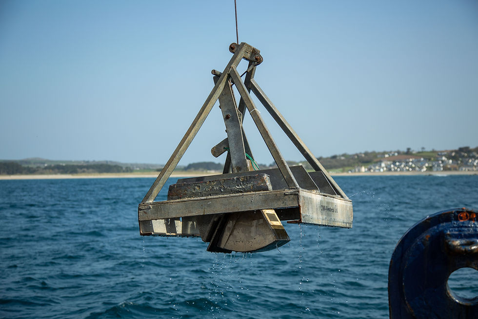
CMS GeoScience deployed two 0.1m² Hamon grabs, a purpose-built Mega Grab and DDV to obtain seabed sediment and benthic infauna samples across the array. The samples collected will undergo particle size and macro faunal analysis to assess the seabed and inform future operations.
This particular site, out in the Eastern Channel, meant working within the busy TSS, hard ground conditions and an exposed seabed in an area heavily impacted by weather. This contributed to a challenging but rewarding job for our team. A key aspect of this job was that sampling needed to be completed early in the year to allow ample time for laboratory analyses and reporting.
Our success came down to a coordinated effort of all crew and personnel working 24-hour operations aboard our vessel, MV FlatHolm, supported by a dedicated chef to ensure the comfort and wellbeing of the whole team day and night.
Following demobilisation, MV FlatHolm is remobilising straight away for multiple 24-hour geophysical surveys that will run for the duration of May and into June. These jobs involve the use of multibeam echosounders (MBES), sidescan sonar, magnetometer and boomer surveys.
The successful completion of this project proves our continued capability to perform large-scale, 24-hour grab sampling operations in challenging environments and collect high-quality, reliable data that is delivered safely, ahead of time, and to budget.
CMS GeoScience’s survey solutions go beyond simple data collection. Our rigorous and safety-first operations, reliable in-house team and bespoke kit provide accurate and cost-effective survey solutions for any job you may require.
The Dublin Array Offshore Wind Farm Project, RWE Renewables
CMS GeoScience successfully carried out site investigation surveys for RWE Renewables UK at their proposed offshore wind farm site on Bray Bank and Kish Bank off the coast of Dublin, Ireland.
We performed a suite of geotechnical tests to gather data to inform the development of the site.
When complete, the Dublin Array will comprise of between 39 and 50 wind turbines, power over 770,000 Irish homes and reduce Ireland’s carbon emissions by ~1.5 million tonnes annually.
CMS GeoScience completed the project on time, meeting all the key milestones and avoided any health & safety issues and technical downtime.

The Dublin Array Offshore Wind Farm Project, RWE Renewables
Falmouth Docks
CMS GeoScience operates far and wide, but this was a great opportunity to work on an exciting maritime development much closer to home here in Falmouth.
Working in conjunction with A&P Falmouth, part of the APCL Group, and Geotechnical Engineering Ltd, CMS GeoScience carried out a successful geotechnical survey within Falmouth Docks as part of the initial stages of a regeneration project. Our experienced geotechnical team were able to collect 26 vibrocores for archaeological and MMO analysis.
The challenges associated with this project were demanding but proved to be an opportunity to put our robust and proven geotechnical systems to the test, resulting in a productive campaign for all involved.
The Convex Seascape Survey
CMS GeoScience partnered with the University of Exeter to work on The Convex Seascape Survey.
This exciting initiative is a pioneering collaboration of world-leading scientists, working to quantify and understand blue carbon stored in the coastal ocean floor and the effects of marine life upon it.
The role of our specialised geotechnical team was to collect 55 vibrocores and 8 multicores across various locations in the waters around Jersey.
Demanding environmental, geological and weather factors presented a specific challenge to the team, with rocky outcrops exposed by the high tidal range. Extensive planning using tidal and weather forecasts, as well as water depths, enabled the team to maximise working windows and complete work safely.
We are proud to have played our part in helping researchers highlight the need to preserve integral marine habitats.